The National Trust, Europe’s largest conservation charity, is working with leading geospatial anaIytics company, Rezatec, to remotely establish a baseline of hydro-morphological, ecological, soil and carbon characteristics to support project planning and underpin ongoing monitoring for their large-scale landscape recovery project on the Holnicote Estate, Somerset.
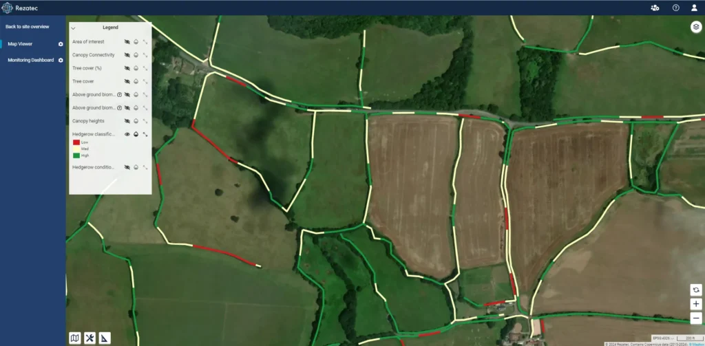
“At the National Trust we’re collaborating with multiple stakeholders to deliver significant, long-term land use change across 6,700 acres of land adjoining the Holnicote Estate. Connecting up nature across the woodlands is a huge part of this,” says Annie Murray, project manager. “Rezatec provides the ideal remote sensing tool to capture robust metrics for canopy connectiveness, helping us measure how the project is improving nature across a wide area for the long term.”
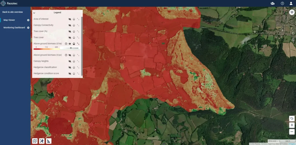
“Rezatec is delighted to leverage our work with leading forest management and agriculture companies across the globe to deliver the National Trust a comprehensive baseline of above-ground biomass and hedgerow condition, robust metrics for canopy connectiveness and use space-borne radar to deliver dynamic on-going monitoring,” adds Camilla Braithwaite, Head of Product at Rezatec.
“These insights, powered by Rezatec’s leading geospatial AI platform, will support the Trust to deliver their vision to embrace natural processes and support land managers to create space for water, restore woodland and re-introduce keystone species.”
Click here for more information on the National Trust’s landscape recovery project on the Holnicote Estate.